


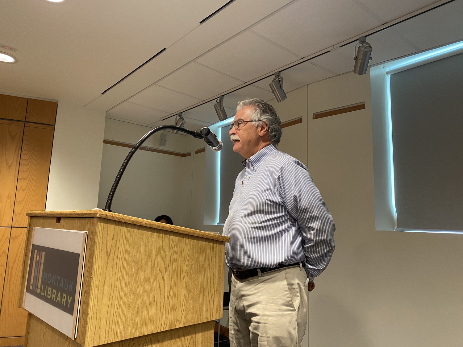
Brian Frank, East Hampton Town's chief environmental analyst, did not support a zone change request at Culloden Shores in Montauk. CHRISTOPHER WALSH
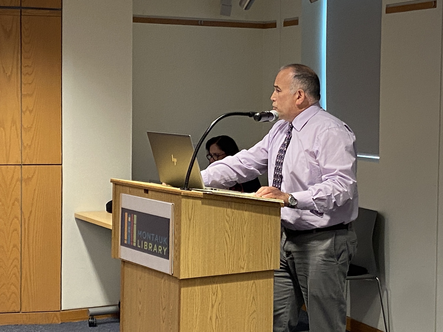
Aram Terchunian told the East Hampton Town Board that four properties at Culloden Shores in Montauk should be moved to a different Coastal Erosion Overlay District zone. CHRISTOPHER WALSH
A sometimes tense East Hampton Town Board work session in Montauk, which laid bare the tension between protecting natural resources — in this instance, the shoreline — and the fear of losing one’s home and property to erosion, played out at the Montauk Library on Tuesday, July 9.
Owners of the contiguous properties at 180, 184, 188 and 192 Soundview Drive — immediately west of Captain Kidd’s Path, where a steel bulkhead and stone armor revetment at its western end encroaches onto 180 Soundview and other waterfront properties that are armored with rock seawalls — have requested a change of their Coastal Erosion Overlay District zone designation from Zone 2 to Zone 4, in an effort to gain permission to install shore-hardening structures to combat the erosion of their shorelines.
The former zone is defined as a bay coastal zone that is predominantly free of erosion control structures. The latter, which spans the shoreline from the western jetty at Montauk Harbor to just east of 180 Soundview Drive, is also defined as a bay coastal zone, but containing numerous erosion control structures, and “where the loss of natural resources and features … means that in many cases erosion control structures provide the only remaining protection against flooding and erosion.”
Inlets, said Brian Frank, the town’s chief environmental analyst, serve to interrupt littoral processes. The jetties at the mouth of the harbor, constructed in 1926, have always caused downdrift erosion, later codified by Zone 4’s demarcation from the western jetty to Soundview Drive. Shore hardening along Captain Kidd’s Path further starves the shoreline to the west of sand, compounding erosion happening along Soundview Drive.
Maurice and Sarah Iudicone, of 184 Soundview Drive, have lost more than 24 feet of bluff this year, Alice Cooley, an attorney representing them and Richard and Donna Appell of 180 Soundview Drive, said after the meeting. “Winter storms severely degraded their property.”
After purchasing the property in 2017, the Iudicones started the process of trying to restore their bluff, and in November 2022 got approval from the town for the placement of sand, a “soft” solution rather than a hard structure such as a revetment or geocubes, which cause scour and loss of adjoining shorelines.
But it was the Planning Department’s recommendation that the solution would not work, Cooley said, and after conferring with then-Town Attorney John Jilnicki opted to request a zone change. That request was submitted last November. Her clients, Cooley said, meet the criteria to be included in Zone 4.
But on Tuesday, Frank delivered a Planning Department report stating that the properties in question are more accurately defined as in Zone 2 than Zone 4.
“These properties,” he said, “are much more accurately considered as part of the eastern extreme of almost 8,000 linear feet of shoreline that is completely free of legally existing erosion control structures” and are properly classified as in Zone 2, he said. The four properties have “much more in common” with properties to their west than to their east.
Should the Town Board pursue a zone change, it would have to do so in compliance with the State Environmental Quality Review Act, or SEQRA, a laborious process involving completion of a full environmental assessment form, coordinated review with other involved agencies, written comments from the Planning Board, and a public hearing.
A zone change also would have to be deemed consistent with the town’s Local Waterfront Revitalization Program, or LWRP, a land and water use plan and framework within which critical waterfront issues are addressed and improvement projects implemented, which Frank said would be difficult.
Robert Connelly, the town attorney, told the board that the question before it was whether or not an error was made when the zone was established, as the property owners assert, and if so, whether it should be addressed by changing the zoning district. Frank disagreed with the suggestion that the zones’ demarcations were made in error.
A prohibition against erosion control structures in Zone 2, however, is not absolute, Frank said in answer to a question from the board: A natural resources special permit and variance from the Zoning Board of Appeals would allow the relief the property owners seek.
But the board, with one exception, was cool to a zone change, suggesting instead that the property owners seek relief from the ZBA. Councilman Ian Calder-Piedmonte said that he was “very sympathetic” to the applicants whose properties are adjacent to hard structures that preexisted the LWRP. “I am somewhat open to including these in that other erosion overlay district,” he said. “I’m not convinced there was an error, but a change of circumstance,” he said, referring to worsening erosion.
But there are “significant differences” between the four properties in question and those to the east in Zone 4, Supervisor Kathee Burke-Gonzalez observed.
Councilwoman Cate Rogers, a former member of the ZBA, pointed to that board as the appropriate venue. The Planning Department, Frank said earlier, would provide the ZBA with “a lot more site-specific, detailed history of this property” as well as the adjoining properties. “Any land-use application would have to dig deep and address them in detail.”
Cooley told the board that “we disagree with the report’s conclusion.” Yes, jetties and hardened structures contribute to erosion, she said, but “I think these four [properties] were overlooked for inclusion in Zone 4. The shoreline in question is not predominantly free of erosion control structures, she said: The property at 180 Soundview Drive “is directly next to a steep bulkhead and stone armor revetment,” encroaching onto 180 Soundview Drive “by almost a foot,” albeit legally. “While these individual properties may be free of erosion control structures, the area is clearly not. These properties are certainly not clear of their effect. … How can a lot be considered without reference to its directly adjoining neighbor?” Her clients are “looking for a solution to a very real problem.” The ZBA, she predicted, would be “very unlikely” to grant the requested relief.
Aram Terchunian of the Westhampton Beach-based consulting and contracting firm First Coastal Corporation also spoke on the property owners’ behalf, telling the board that erosion is not only occurring but accelerating. “We ask you to correct what we believe was a mapping error,” he said. “Some kind of shoreline protection is the only thing that will work,” he said.
Sarah Iudicone told the board that “this wasn’t our first course of action,” recounting the effort to restore the bluff with sand. By the time their application was approved, there “was already too much erosion” for sand alone, First Coastal advising a hard structure in concert with the neighboring Soundview Drive properties. They started that application process in May 2023, “another year into this process,” which she said was “frustrating when you’re trying to follow the process, do everything right, and look for guidance,” but “keep getting pushed to another board, another option.”
She agreed that it would be “extremely unlikely” to obtain relief from the ZBA “for four properties in a row,” hence seeking a zoning change.
“Town boards change zoning laws all the time when there’s new information,” she said. “I hope that you do move as quickly as you can … because the amount of erosion in the last few years has been drastic, and we don’t have any more time.”
In his remarks to the board, Richard Appell agreed with Iudicone’s last sentiment.
Acknowledging that the board did not seem to agree with the property owners that an error was made when the zones’ demarcations were set, Cooley asked that they “consider that circumstances have changed here” and that the board include them on their July 16 work session agenda for further discussion.
“The work session agenda was already packed,” the supervisor said. “We can talk tomorrow.”


